7 Days / 6 Nights
Medium - Challenge
Min: 2 - Max: 8 people
Cusco - Perú
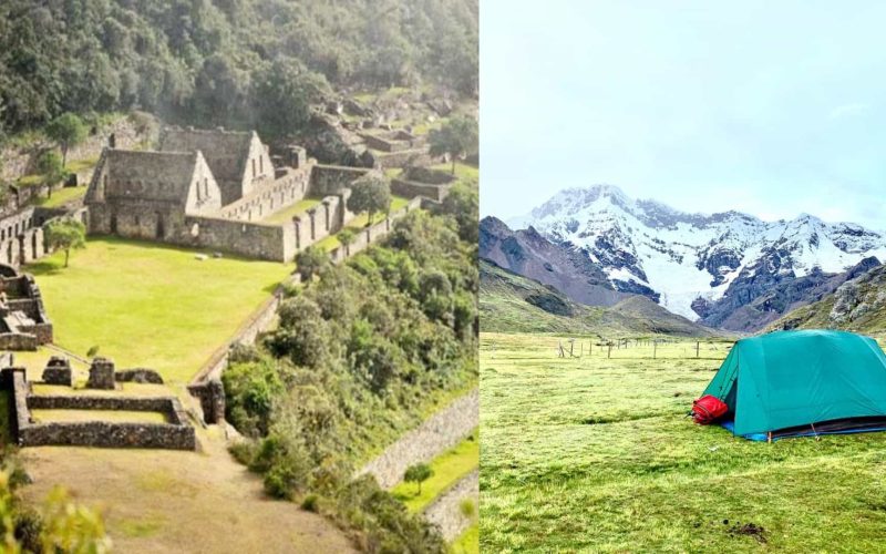
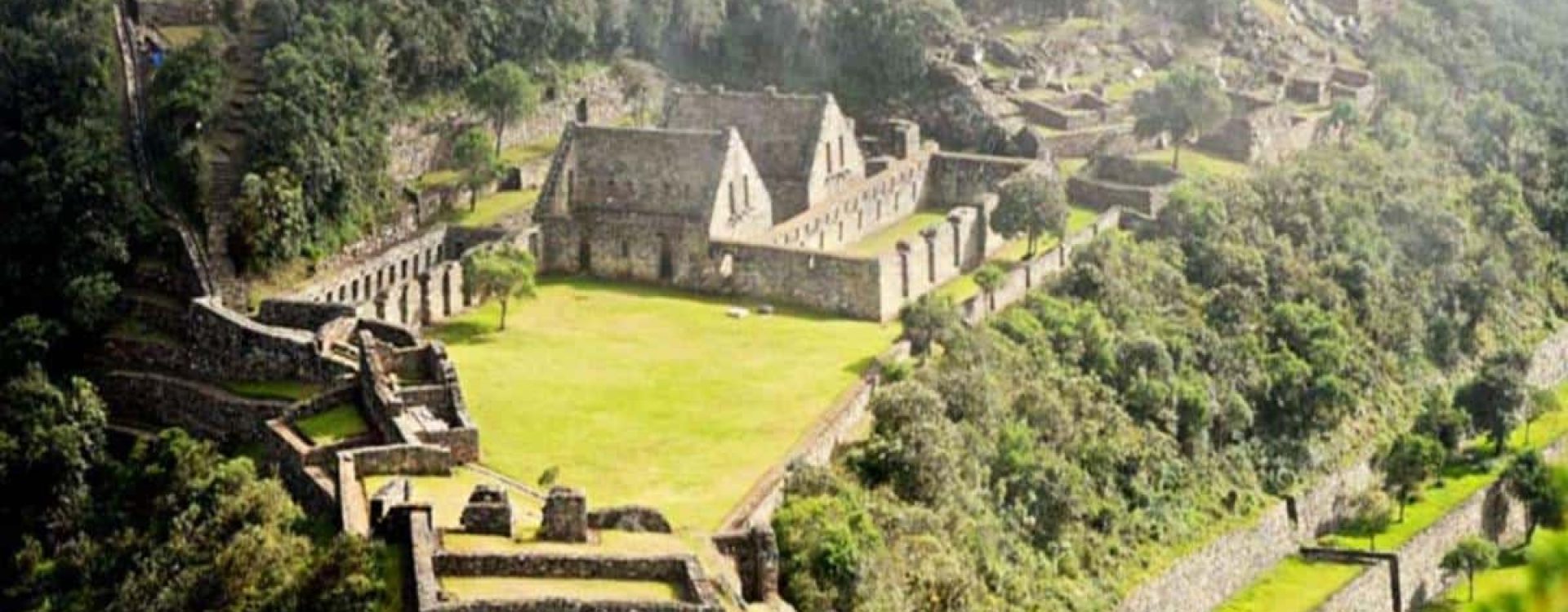
Known as the sister of Machu Picchu, the Choquequirao Trek offers a unique and less-traveled path into the heart of the Andes. Choquequirao, whose name means «Cradle of Gold» in Quechua, is a vast Inca complex that remains hidden from the crowds. It was one of the last Inca strongholds and served as a refuge after the Spanish conquest. For centuries, it was swallowed by the cloud forest, and much of it is still being uncovered by archaeologists today.
| Detail | Information |
|---|---|
| Duration | 7 days / 6 nights |
| Starts from | Cusco, Peru |
| Ends in | [Cusco / Machu Picchu] |
| Max altitude | 4250 mt / |
| Total distance | Approx. 115 km |
| Accommodation | Camping |
| Difficulty | Challenging |
| Group size | Small groups (Min: 2 – Max. 8) |
| Price | $ 850 USD per person |
Our Choquequirao hike is designed for travelers seeking an authentic and challenging adventure. It’s not just a trek, but a journey through living history, dramatic scenery and remote mountain trails. You’ll walk the same paths once used by the Incas, surrounded by steep canyons, waterfalls and valleys that seem untouched by time.
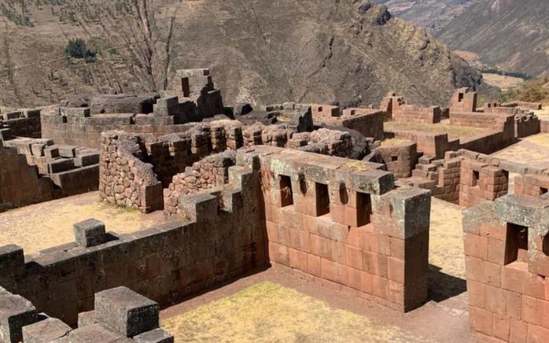
Unlike the busy Inca Trail, the Choquequirao Trek offers peaceful solitude, so you can connect deeply with nature and Andean culture. You’ll camp under the stars, cross hanging bridges and gradually climb to the archaeological site of Choquequirao: an awe-inspiring complex of temples, terraces and sacred spaces, only partly excavated.
At the top, you’ll stand above ancient Inca structures, with panoramic views of the deep Apurímac canyon and the surrounding snow-capped peaks.
This adventure trek in Peru requires good physical condition. The trail has long, steep climbs and descents in and out of the Apurímac canyon. Acclimatize in Cusco for at least 2 to 3 days before starting (learn more about altitude sickness). The effort is worth it: you’ll visit one of the most impressive Inca sites in Peru, with very few other people around.
If you’re looking for a powerful alternative to Machu Picchu, less crowded but equally magical, join Inca Trail For Less on the Choquequirao Trek. It’s a once-in-a-lifetime journey into the soul of the Andes.
Thank you for choosing Inca Trail For Less for your adventure. One or two days before the trek, your guide will meet you at your hotel in Cusco to explain the full itinerary, the equipment you’ll need and what to expect each day. It’s the perfect time to ask any final questions.
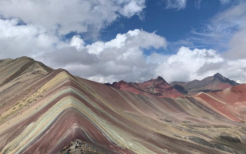
Looking for other alternative treks? Try the Inca Quarry Trail Trek, the Salkantay Trek to Machu picchu or the Rainbow Mountain and Machu picchu If you prefer an easier visit to Machu Picchu, see our Ollantaytambo and Machu Picchu tour.
04:00 am – Pickup in Cusco. Our private van picks you up at your hotel for a 4-hour drive to Capuliyoc, the starting point of the Choquequirao Trek to Machu Picchu.
Capuliyoc viewpoint. Located on the edge of the Apurímac canyon, one of the deepest canyons in the world, Capuliyoc offers spectacular views. With some luck, you’ll see Andean condors flying over the canyon.
Downhill hike to Chiquisca. We start the trek going downhill for about 2 hours into the canyon until we reach Chiquisca, where our cook serves a hot lunch.
Uphill to Rosas Pata. After lunch, we hike uphill for about 1.5 hours to Rosas Pata, our campsite for the night. Dinner is served at the camp, and you’ll spend your first night under the stars.
| Detail | Information |
|---|---|
| Accommodation | Camping at Rosas Pata |
| Min altitude | 1,550 m / 5,085 ft |
| Max altitude | 3,324 m / 10,906 ft |
| Walking distance | 14 km / 8.7 mi |
| Walking time | Approx. 4 hours |
| Weather | Warm and windy; hot at the bottom of the canyon |
| Meals | Lunch, dinner |
| Difficulty | 3 – Moderate to challenging |
| Start time | 04:00 am |
| End time | Approx. 06:00 pm |
Early start after breakfast. After a hearty breakfast at camp, we begin the most demanding climb of the trek.
Uphill to Marampata. We won’t lie to you: the 4-hour climb to Marampata is challenging. But once you reach the top, the effort is rewarded with a breathtaking first view of the ruins of Choquequirao, spread across the mountainside above the Apurímac canyon. Here we stop for lunch.
Arrival at Choquequirao. After lunch, we walk about 2 more hours to reach the archaeological site at 3,100 m (10,171 ft). We set up camp, relax and enjoy the sunset over one of the most impressive and least visited Inca cities in Peru.
| Detail | Information |
|---|---|
| Accommodation | Camping near Choquequirao |
| Min altitude | [X] m / [X] ft (Rosas Pata) |
| Max altitude | 3,100 m / 10,171 ft (Choquequirao) |
| Walking distance | 13 km / 8.08 mi |
| Walking time | Approx. 6 hours |
| Weather | Warm during the day; cool at night |
| Meals | Breakfast, lunch, dinner |
| Difficulty | 4 – Challenging |
| Start time | 05:00 am |
| End time | Approx. 06:00 pm |
Morning at Choquequirao. After waking up in this beautiful place and enjoying a good breakfast, you’ll have the whole morning to explore Choquequirao at your own pace. Walk among its temples, plazas and terraces, including the famous llama terraces, and enjoy the site with almost no other visitors around. Then, rest before lunch at camp.
Downhill to Pinchinuyoc. After lunch, we slowly head downhill for about 2 hours to the Inca ruins of Pinchinuyoc, a small site surrounded by terraces and water channels. We set up camp here for the night.
| Detail | Information |
|---|---|
| Accommodation | Camping at Pinchinuyoc |
| Min altitude | 3600 m / [X] ft (Pinchinuyoc) |
| Max altitude | 3,200 m / 10,499 ft |
| Walking distance | 10 km / 6.21 mi |
| Walking time | Approx. 4 hours (including exploring Choquequirao) |
| Weather | Warm |
| Meals | Breakfast, lunch, dinner |
| Difficulty | 1 – Easy |
| Start time | 05:00 am |
| End time | Approx. 06:00 pm |
Descent to the Río Blanco canyon. After breakfast, we descend to the canyon of the Río Blanco (White River), at 1,990 m (6,529 ft). Along the way, you’ll enjoy beautiful views of the deep valleys and the green slopes of the canyon.
Rest and lunch by the river. At the bottom, you’ll have time to relax by the river, have lunch and recharge your energy for the climb ahead.
Uphill to Maizal. In the afternoon, we start a challenging 4-hour climb up the other side of the canyon. It’s one of the hardest parts of the trek, but the views get better with every step. We reach Maizal, a small farming area, where we camp for the night.
| Detail | Information |
|---|---|
| Accommodation | Camping at Maizal |
| Min altitude | 1,990 m / 6,529 ft (Río Blanco) |
| Max altitude | 2,500 m / 8,202 ft |
| Walking distance | 10 km / 6.21 mi |
| Walking time | Approx. 6 hours |
| Weather | Warm and windy; hot at the bottom of the canyon |
| Meals | Breakfast, lunch, dinner |
| Difficulty | 4 – Challenging |
| Start time | 05:00 am |
| End time | Approx. 06:00 pm |
Through the cloud forest to the Victoria Mines. After an early wake-up and breakfast, we hike for about 4 hours through the cloud forest, surrounded by lush vegetation, to the old Victoria Mines. Here we visit the mines and other nearby ruins.
Victoria Pass (4,130 m). One more hour of walking takes us to the Victoria Pass, at 4,130 m (13,550 ft), the highest point of the day. From here, you’ll enjoy wonderful views of the snow-capped peaks and deep valleys.
Descent to Yanama. We descend to Yanama, a traditional Andean village where time seems to stand still.
Drive to Lucmabamba. From Yanama, our private minivan takes us to Lucmabamba. We enjoy a delicious dinner and rest at our campsite.
| Detail | Information |
|---|---|
| Accommodation | Camping at Lucmabamba |
| Min altitude | 2,500 m / 8,202 ft |
| Max altitude | 4,130 m / 13,550 ft (Victoria Pass) |
| Walking distance | 12 km / 7.46 mi |
| Walking time | Approx. 6 hours |
| Weather | Warm in the cloud forest; cold and windy at the pass |
| Transportation | Walking, private minivan |
| Meals | Breakfast, lunch, dinner |
| Difficulty | 4 – Challenging |
| Start time | 05:00 am |
| End time | Approx. 06:00 pm |
Inca path through the cloud forest. After breakfast, we follow an original Inca path for about 3.5 hours through the cloud forest, surrounded by absolutely beautiful scenery, orchids and coffee plantations.
Llactapata ruins (2,700 m). We reach the Inca site of Llactapata, at 2,700 m (8,858 ft). After visiting the ruins, you’ll enjoy an amazing view of Machu Picchu from a unique angle, just across the valley. It’s your first look at the Inca citadel.
Descent to Hidroeléctrica. We walk downhill for about 1.5 hours to the Aobamba River, then about 20 more minutes to Hidroeléctrica, where we have lunch.
Train to Aguas Calientes. At 3:00 pm, we take the train to Aguas Calientes, the town at the foot of Machu Picchu. We check in at our hotel, where you can finally enjoy a hot shower and a comfortable bed. Dinner is served at a local restaurant. Rest well: tomorrow is Machu Picchu.
| Detail | Information |
|---|---|
| Accommodation | Hotel in Aguas Calientes |
| Min altitude | 2600 m / |
| Max altitude | 2,700 m / 8,858 ft (Llactapata) |
| Walking distance | 18 km / 11.18 mi |
| Walking time | Approx. 5.5 hours |
| Weather | Warm and humid in the cloud forest |
| Transportation | Walking, train |
| Meals | Breakfast, lunch, dinner |
| Difficulty | 4 – Challenging |
| Start time | 05:00 am |
| End time | Approx. 06:00 pm |
05:00 am – Bus to Machu Picchu. After an early wake-up, we take the first buses up to Machu Picchu, a 30-minute ride. Remember to have your original passport ready for the entrance control.
Guided tour of Machu Picchu. Your guide leads a 2.5-hour tour through the most important places of the Inca citadel: its temples, plazas and terraces. After the tour, you’ll have free time to explore on your own and take photos. After seven days of trekking, this is the perfect reward.
Optional: Huayna Picchu. If you’d like to climb Huayna Picchu, the steep mountain behind the citadel, let us know when you book. Tickets are limited and sell out months in advance. They have an extra cost.
Return to Cusco. We take the bus back down to Aguas Calientes and board the train to Ollantaytambo. There, our private bus will be waiting to take you back to your hotel in Cusco, where the Choquequirao Trek to Machu Picchu ends.
| Detail | Information |
|---|---|
| Accommodation | Not included (end of the tour) |
| Min altitude | Aguas Calientes – 2,040 m / 6,690 ft |
| Max altitude | Machu Picchu – 2,430 m / 7,970 ft |
| Walking time | Approx. 3 hours (inside Machu Picchu) |
| Weather | Cool morning; warm and humid at midday |
| Transportation | Bus, train, private bus |
| Meals | Breakfast |
| Difficulty | 1 – Easy |
| Start time | 04:30 am |
| End time | Approx. 6:30 pm (arrival in Cusco) |
Transportation
Entrance tickets
Accommodation
Meals
Camping equipment
Staff and support